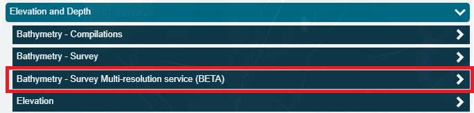
New data on the Data Portal: Bathymetry – Survey Multi-resolution service (BETA)
CSIRO and AusSeabed would like your feedback on new Multi-Resolution Service.
Please email either ausseabed@ga.gov.au, or CSIRO directly cisco.navidad@csiro.au with feedback regarding the service. Suggested topics would include but NOT limited to:
* Download capability through our data url link - DAP (Data Access Portal)
* Any missing functionality? Improvement suggestions?
* Visualisation experience with zoom levels (different resolutions)
There are currently 38 multi-resolution layer groups available for your viewing pleasure and over 1.5 million square kilometres in area coverage to the portal.
This multi-resolution service BETA presents individual layer geotiffs combined in a layer group each at designated resolution levels defined by depth bands. As you zoom in and out at different scales, the highest resolution possible for a particular depth range (zoom level) will be made available. Utilisation of Geoserver’s internal GeoWebCache will enable pre-rendered tiles stored at the publisher’s repository to better optimise visualisation on the portal.
A matrix of resolution levels versus depth ranges modified after NOAA (2019) and sourced from the Multibeam Guidelines v.2 can be found in the link below: https://www.ausseabed.gov.au/__data/assets/pdf_file/0010/95887/Multibeam-Guidelines_v2.pdf
Additionally, there is a Contour base feature layer contoured at 100m intervals (using the lowest resolution for a given tile) allowing the viewer to better examine geomorphic features in addition to the hillshade layer.
*The clip-zip-ship tool service currently is not working with the WMTS service; however, we will use direct integration through the OGC WMS once a new CSIRO AusSeabed Geoserver instance can be established before October 2023, to re-enable all the portal functionality such as clip-zip-ship.
A complete survey dataset bundle is available at data URL links on the inspection tool. The CSIRO Data Access Portal will allow the full set of L2 and L3 datasets to be downloaded for a given survey.
Select to activate the desired Survey Layer, and zoom to extents, if you click on the layer, the Inspection Tool panel will reveal the metadata and links available.
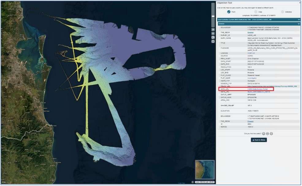
The “Data URL” link to CSIRO Data Access Portal (figure 2) takes you directly to the CSIRO Data Access Portal (DAP), which hosts all the L2 and L3 products published to AusSeabed for that survey.
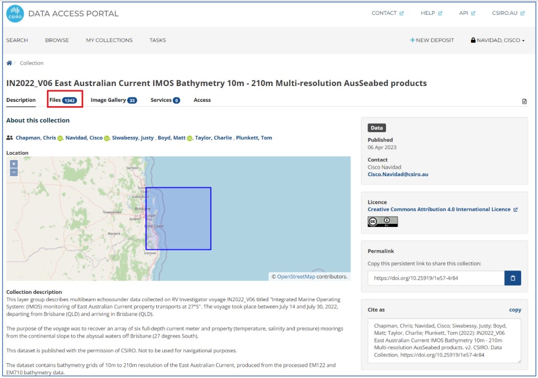
You can filter and download the datasets you require (figure 4) as multiple different resolution floating point geotiffs or other ungridded datasets such as L2 point cloud GSF’s.
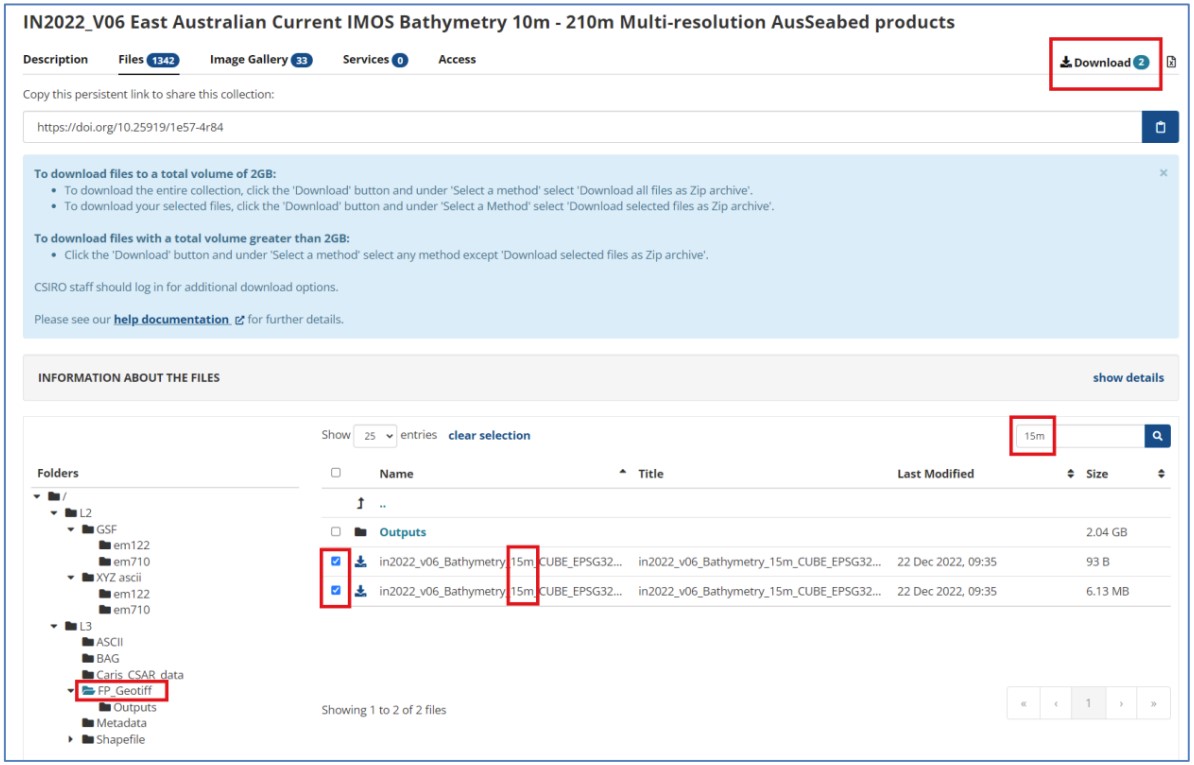
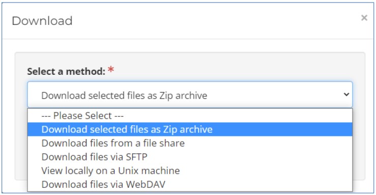
Download the datasets required using the different methods available below.