Schmidt Ocean Institute’s RV Falkor New Year voyage maps over 40,000 square km
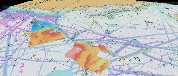
The Schmidt Ocean Institute’s year-long series of RV Falkor expeditions within Australia’s waters continued with another successful expedition to the northern Tasman Sea and Coral Sea Marine Park. The ‘Pinging in the New Year’ voyage, collected some of the first data for start of the UN Ocean Decade of Ocean Science (2021-2030) while flying the flag of the GEBCO-Seabed 2030 Project. By the end of January, the Falkor had mapped 40,445 sq km across the Recorder and Fraser seamounts, around Cato Reef and on the Chesterfield Plateau.

A screen capture of the ~40,000 sq km mapped by the RV Falkor during the ‘Pinging in the New Year’ voyage to the Tasman and Coral seas.
Schmidt Ocean Institute’s RV Falkor voyage to the remote Coral Sea Marine Park
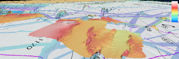
In February, the RV Falkor departed Brisbane for the Seafloor to Seabirds in the Coral Sea voyage to the eastern Coral Sea Marine Park on the remote Kenn Plateau and Coriolis Ridge. As of 25 February, the Falkor had mapped about 24,000 sq km, revealing the ancient basaltic and continental crusts that shape the seafloor here as a result of the breakup of Gondwana. Priority mapped areas included IUCN Special Purpose zones in the Coral Sea Marine Park, for assisting management by Parks Australia. The SOI-produced video Beneath the Waves explains further why we are mapping.

A screen capture of RV Falkor’s mapped areas for both the ‘Pinging in the New Year’ and ‘Seafloor to Seabirds in the Coral Sea’ voyages.

A screen capture of the (currently) ~24,000 sq km mapped by the RV Falkor during the ‘Seafloor to Seabirds in the Coral Sea’ voyage.